The Faster Way from Scan to BIM
Avillence is an AI-powered platform to generate accurate BIM models from point cloud & laserscan data.
AI-powered tools for your Scan2Bim workflows.
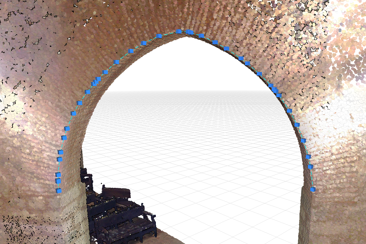
Edge Extraction
Extract building edges from point clouds with a single click. Click on any edge in your point cloud, and our algorithm automatically detects and extracts it as a precise polyline. No manual tracing or complex workflows - just point and click to generate accurate edge geometry for your BIM models.
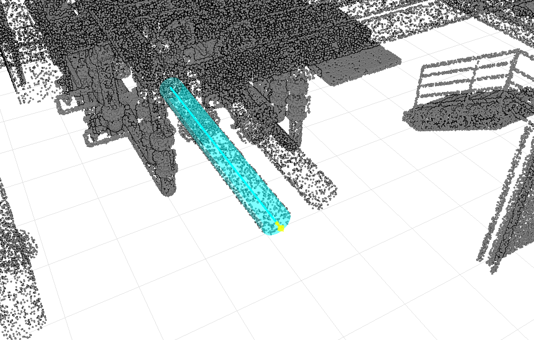
Pipe and Beam Extraction
Extract pipes and beams from point clouds with a single click. Click on any pipe or beam in your point cloud, and our algorithm automatically detects and extracts it as a precise 3D element. No manual modeling or complex workflows - just point and click to generate accurate pipe and beam geometry for your BIM models.
And Many More...
We are constantly working on new features and improvements to our platform. Stay tuned for more updates and new features.
Exchange Data
Exchange data with the BIM or CAD Software of your choice.
Work from anywhere with our cloud-based platform.
Access your projects from anywhere, collaborate with your team in real-time, and never worry about software updates or installations. Our cloud-based platform automatically scales to handle projects of any size, ensuring you always have the resources you need. What sets us apart is our browser-optimized technology that delivers zero load times for even the largest point clouds — no waiting, no buffering, just instant access to your data. Best of all, you don't need expensive workstations or specialized hardware. Our platform runs smoothly on any basic laptop, making professional-grade Scan2BIM tools accessible to everyone, anywhere.